
News
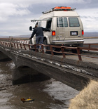
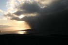
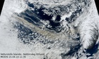
Jökulhlaup from Grímsvötn subsides
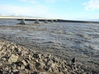
The jökulhlaup (glacial outburst flood) from Grímsvötn that began near the end of October is now coming to an end. In past centuries, most jökulhlaups from Grímsvötn have entered the course of the river Skeiðará. This time, however, floodwater that emerged from beneath the eastern part of the glacier went westwards along the glacier margin and then entered the river Gígjukvísl. In the summer of 2009, the shift occurred and water has ceased to enter the course of Skeiðará.
Read more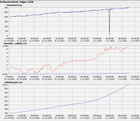
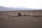
A jökulhlaup from Grímsvötn

The Climate and Energy Systems project final conference
Webpage on travel safety
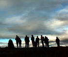
NONAM conference in August
Hydrology of Eyjafjallajökull
Latest observations at Eyjafjallajökull
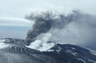
Eyjafjallajökull eruption
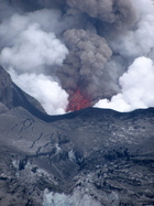
Magma splatters ejected
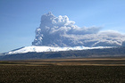
The Eyjafjallajökull plume
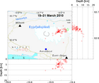
Ash carried southward and east
Winds from the north carry the ash southward, where westely winds in the upper atmosphere carry it towards the east. The wind directions are not expected to change much during the next few days.
Read more
Ash clouds and flash floods
Ash cloud extending to Europe
A satellite image sequence shows volcanic ash cloud extending to Europe, 15 April 2010, from the eruption in Eyjafjallajökull.
Read more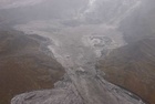
Ongoing eruption
New eruption in Eyjafjallajökull
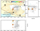
The volcano measured
Institute of Earth Sciences, University of Iceland, has measured the size of the new volcano which has formed around the craters at the eruption site on Fimmvörðuháls.
Read more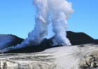
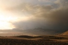
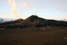
The eruption continues with little changes
Reduced visibility (10 m) and risky weather keep visitors well away from the eruption now; all access is restriced. Lava fountains have been active both northeast of the main crater and in the old crater. Most of the lava seems to accumulate near the vents, but there are intermittent flows into the gullies of Hruná and Hvanná.
Read more
The magma path revealed
Ninth day of the eruption
The eruption in the Eyjafjallajökull volcanic system has been on a small scale so far and tremor signals are diminishing, at least for the time being.
Read more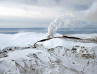
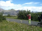
Photos from Fimmvörðuháls
Eruption on Fimmvörðuháls
Search
Contact IMO
© Veðurstofa Íslands | Bústaðavegi 7- 9 | 105 Reykjavík | Phone 522 6000 | Fax: 522 6001
Recording 902 0600 | SSN 630908-0350
Contact us | Employees | Terms and conditions | Sitemap


