
Latest news on the eruption at Reykjanes peninsula
This item will be updated when new information arrives.
See also IMO's Twitter feed for important updates.
Updated 23.8. 2022
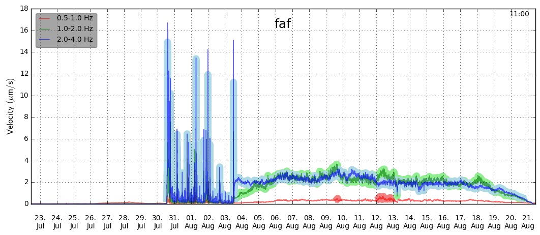
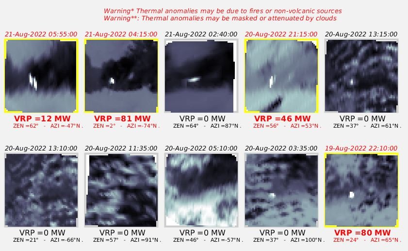
The eruption in Meradalir, which commenced on the 3rd of August, ceased to issue lava on the 21 of August. Volcanic tremor started to decrease steadily from the 18th and stopped completely during the night of 21st. The activity at the crater ceased at the same time, with no visible extrusion of fresh lava. The figure shows the tremor for the last month (from faf station operated by ISOR), where it is possible to identify the onset of the eruption, its progression and also decline. A thermal anomaly within the area was still detectable on satellite images (Mirovaweb.it) during last night (23.08) as well as glowing lava in the lava field which was observed via web cameras. This cessation in activity likely marks a new phase in the Reykjanes volcano-tectonic unrest, but it is too premature to determine if and when the seismic activity will resume and when a new dike propagation or eruption will start again.
IMO emphasizes that volcanic hazards are still present in the area (including passive degassing and fresh lava) and people are asked to be careful when visiting the area and to follow instructions and advice as given by the local Police and Civil Protection authorities.
Updated 8.8. at 13:00
Gas pollution at the eruption site can at any time exceed danger levels. The eruptive plume follows the wind direction, and it is therefore safer to watch the eruption with the wind direction behind you, rather than towards you.
In calm/light wind (<5 m/s) gas can accumulate in the valleys, then circulation is controlled by the landscape and gas can exceed danger levels far up the slopes, all around the eruption site. In such cases, spectators need to move up to higher ground levels such as mountains and ridges and not stay on the slopes just above the eruption.
Choose a walking route according to the wind forecast for the time of the walk.
Avoid taking dogs with you to the eruption site. Dogs are more exposed to gas pollution as they are closer to the ground. Fluoride can also accumulate in puddles in the area.
A link to the gas pollution forecast
In addition to gas pollution people are exposed to hazards in zones as indicated on the map below.

Updated 5.8. at 13:00
Following the onset of
the eruption the inflation signal that accompanied the intrusion is diminishing
rapidly. GPS data suggests that the flow of lava in the eruption is reaching
equilibrium with the flow from below. This means that seismic
activity will diminish.
A total of 2.700 earthquakes were detected on the day before the eruption. However, yesterday only 900 earthquake were detected during the same time span and today only 300 earthquakes have been detected since midnight when this article is written. This fits nicely with the data from GPS and satellite signals, which show that more balance is now over the area.
Updated 4.8.2022 at 12:12
Gas dispersion forcast has been activated for the eruption in Merardalir. It is important for all to be aware of sudden gas pollution near the eruption site and be aware. You can find the forecast here as well as you can use the button on the front page, Reykjanes.
Updated 4.8.2022 at 10:30
The eruption that started yesterday, in Merardalir, continues. Around 400 earthquakes have been measured and they are fewer and smaller than before the eruption. That is expected if compared to the eruption that was last year in Fagradalsfjall. It is likely that pollution can be detected due to the gas release and people are strongly advised against approaching the eruption until further notice as the situation is uncertain. Scientists are evaluating the eruption in the new location and gas monitors will be set up tomorrow.
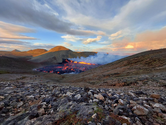
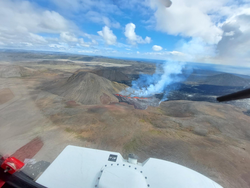
Photo taken yesterdat at the eruption site (Photo:The Icelandic Met Office/Halldór Björnsson)
At 13:18 GMT today lava began flowing from a ground fissure around Fagradalsfjall near the town of Grindavík on the Reykjanes peninsula. The eruption follows intense seismic activity over the past few days.
The site of the eruption is close to last year's eruption that lasted for about six months (see a red line on the map below). According to the Icelandic Met Office, the exact location of the fissure is in Meradalir about 1.5 km north of Mt. Stóri-Hrútur. The area is in southwest Iceland, about 15 km from Keflavik International Airport and about 25 km from the Reykjavík metropolitan area.

The eruption is considered to be relatively small and due to its location, there is low threat to populated areas or critical infrastructure. However, it is possible that pollution can be detected due to the gas release so people are advised against visiting the site.
Currently, there have been no disruptions to flights to and from Iceland and international flight corridors remain open.
The response to the ongoing volcanic activity is led by the Department of Civil Protection and Emergency Management of the police in cooperation with the Icelandic Meteorological Office and University of Iceland.
The
eruption is classified as a fissure eruption (often referred to as
Icelandic-type) and does not usually result in large explosions or significant
production of ash dispersed into the stratosphere.


