
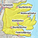
Avalanche bulletin - Eastfjords 
-
Tue Apr 23

Moderate danger -
Wed Apr 24
Moderate danger -
Thu Apr 25
Moderate danger
The weekend was warm and a few avalanches were seen in the area. A skier triggered a small avalanche in Oddsskarð on Sunday. Small avalanches could continue to occur in the next few days. A lot of snow is still in the mountains and inland, and layers could still be present.
Avalanche problems in the area
-
Type
-
HeightAll heights
-
Aspect
-
Probability
-
Size
Small sluffs could occur.
Snow layers and snow cover
A lot of snow is still in the mountains. Saturday was warm and a few small sluffs occurred in the area. The snowpack is expected to become stronger when it starts to freeze, but some sluffs could occur in the sun in the next few days. Layered wind slabs were present and some layering could still be in the snowpack. Cornices are widely on S-W aspects. A deep persistent weak layer could still be present at high elevations.
Recent avalanches
A skier triggered a small avalanche in Oddsskarð on Sunday. A few small avalanches occurred in the thaw last weekend. Several loose avalanches seen by Neskaupstaður on Tuesday and Wednesday. Few small avalanches have been seen around the area after last weeks snowfall and warming.
Weather forecast
Light variable winds in the next few days and fair weather. Temperature over freezing during the day but frost at night.


