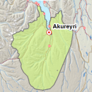
Avalanche bulletin - Eyjafjörður (experimental) 
-
Thu May 09

Low danger -
Fri May 10
Low danger -
Sat May 11
Low danger
Snow has subsided widely in thaw, but less thaw occurred in high elevations where snow could be layered. Snow is affected by diurnal temperature fluctuations and solar radiation, especially in S facing aspects. Possibility of a little new snow in highest mountains.
Snow layers and snow cover
Snow has become wet and subsided in thaw, but a lot of snow is still high in mountains and snow can still be layer there. Stability of snow could lessen with temperature fluctuation and solar radiation during the day, especially in E-W facing aspects that get more sun exposure throughout the day. Possibility of a little new snow in highest mountains where showers of snow occured in the beginning of the week.
Recent avalanches
No reports of recent avalanches.
Weather forecast
Calm weather for the next few days but some rain on Friday/Saturday. Diurnal fluctuations in temperature.