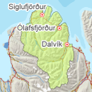
Avalanche bulletin - Tröllaskagi 
-
Thu May 09

Low danger -
Fri May 10
Low danger -
Sat May 11
Low danger
Snow has subsided widely in thaw, but less thaw occurred in high elevations where snow is layered. Snow is affected by diurnal temperature fluctuations and solar radiation, especially in S facing aspects. Possibility of a little new snow in highest mountains on Tuesday and Wednesday after showers of snow/sleet.
Snow layers and snow cover
Thaw and warming started last week and snow has subsided and stiffened somewhat, but considerable snow remains high in the mountains and snow can still be layered. Warm temperatures continue during the day and solar radiation affects the top layers of the snow with chance of wet avalanches, especially in S facing aspects. Possibility of a little new snow in highest mountains where snow/sleet showers occurred. This snow will melt quicly in solarradiation and high temperature.
Recent avalanches
No reports of recent avalanches.
Weather forecast
Calm weather for the next few days but some rain on Friday/Saturday. Diurnal fluctuations in temperature.