
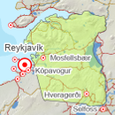
Avalanche bulletin - Southwest corner 
-
Thu May 02

Low danger -
Fri May 03
Low danger -
Sat May 04
Low danger
The snowpack is considered stable after warm weather recently. Little snow is left in the mountains but small wet avalanches are possible high in the mountains inland.
The avalanche bulletin is at a regional scale. It does not necessarily represent avalanche danger in urban areas.
Snow layers and snow cover
Snow has settled well after freeze-thaw cycles and the snowpack is quite stable. Snow profile from Hengill on April 25th showed an isothermal, stable snow pack. Now there is little snow left in the mountains altough small sloughs may release in warm weather.
Recent avalanches
No new reported avalanches.
Weather forecast
Calm southerly winds and minor rainfall on Thursday and Friday. Temperatures generally above 0 degrees in the mountains.


