
News
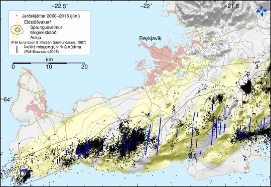
The map shows the location of earthquakes (black dots) over 1 in size at the Reykjanes peninsula during the period from January 2000 until June 2015. Blue lines represent known faults which have been active in Holocene or Recent Epoch, i.e. after the ice age (Páll Einarsson, 2015). Also shown in yellow are volcanic systems with fissure swarms (Páll Einarsson and Kristján Sæmundsson, 1987). Enlarge.


