
News
New eruption in Eyjafjallajökull
A more fierce eruption
After a few days of quiet in Eyjafjallajökull volcano, a new and much more forceful eruption has begun west of Fimmvörðuháls, under the ice-cap.
The eruption is below the highest peak of Eyjafjallajökull, at the southern rim of the caldera.
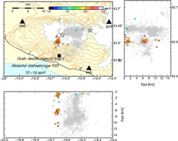
A plume rises at least 8 km into the air. No lava is seen yet but melt-water flows both north and south of the mountain.
See time and magnitude of earthquakes near Mýrdalsjökull (which is the larger ice-cap east of active Eyjafjallajökull) on another map. Note the graph under that map which shows the onset clearly.
Below are aerial photographs of Eyjafjallajökull since 1992 and 2010. Great flows of melt-water are now flowing along Gígjökull glacier.
Eyjafjallajökull 1992
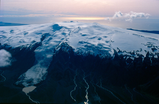
Eyjafjallajökull ice-cap seen from the northwest, 11th September 1992. The caldera is auspicious at the top. The glacier which runs from the caldera towards the north and onto lowland is named Gígjökull, see lagoon in front. Photo: Oddur Sigurðsson.
Eyjafjallajökull 30 March 2010
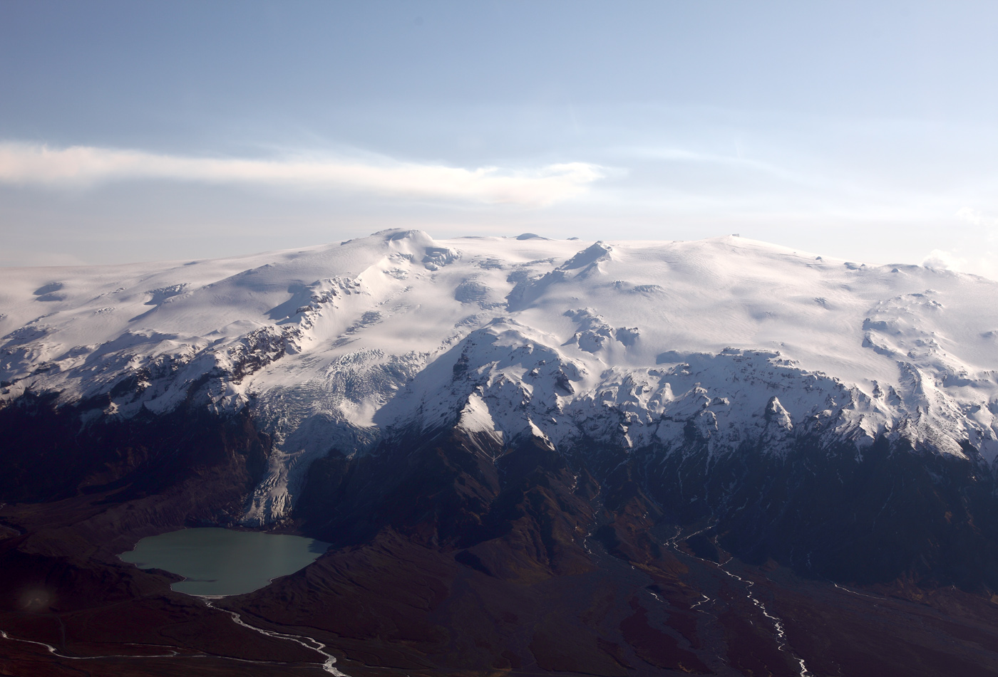
Eyjafjallajökull 30 March 2010. Front left is Gígjökull glacier and lagoon. The glacier has retreated a lot since 1992 (compare above). Photo: Baldur Sveinsson.


