
News
Avalanche web map viewer
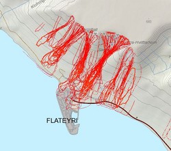
The Icelandic Met Office has developed an experimental avalanche map viewer aimed at easing access of the public and specialists to the avalanche data gathered and processed within the institute.
The project was funded by the Icelandic Avalanche and Landslide Disaster Fund (Ofanflóðasjóður).
The current edition of this viewer features information on snow depth, risk zones, evacuation zones, and past avalanches.
Plans are being made for releasing an improved version of the viewer in the near future, both in Icelandic and English.


