

Earthquake activity east of Grímsey has decreased
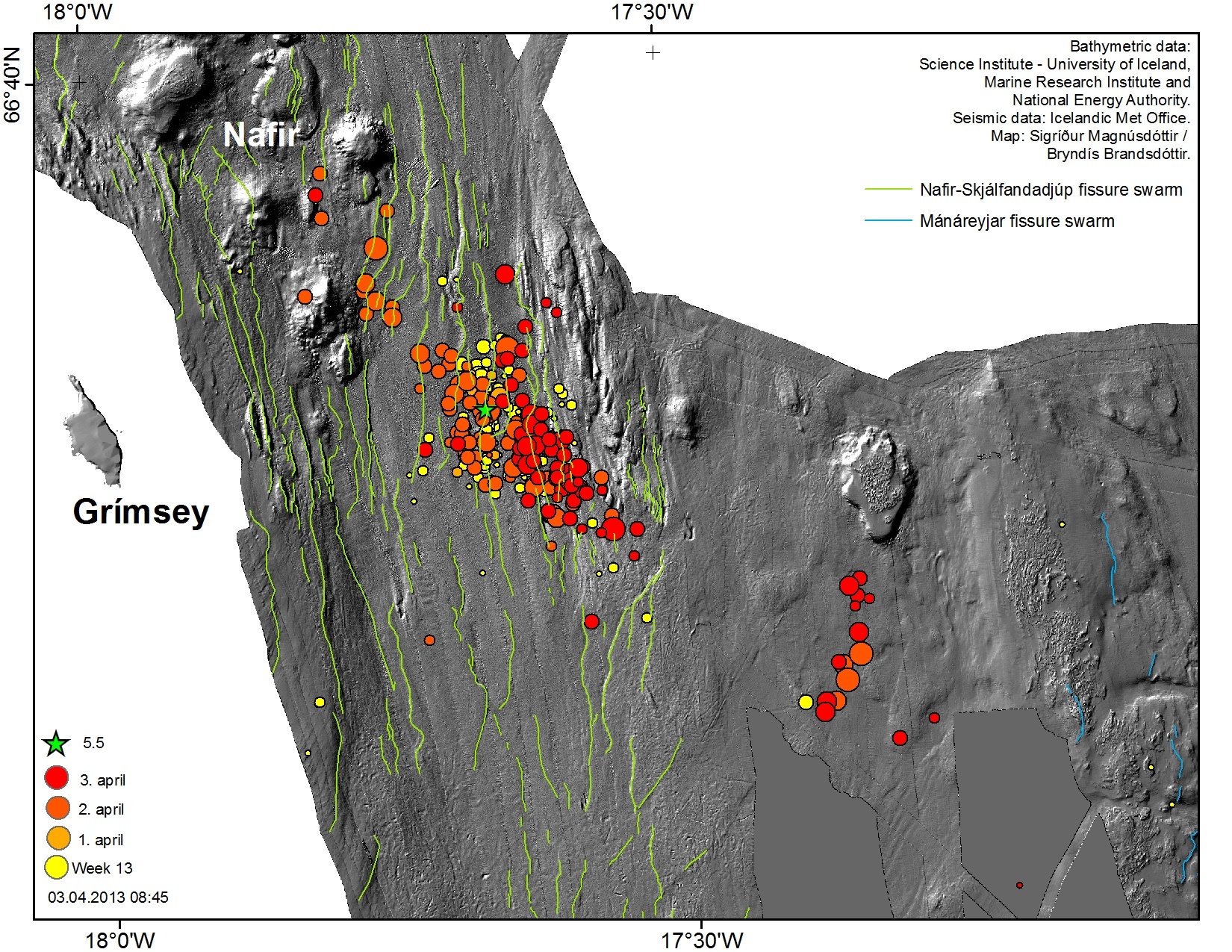
An M5.5 earthquake occurred 00:59 2nd April 2013 15 km east of Grímsey, offshore North Iceland, followed by several hundred aftershocks.
This marked the onset of an intensive swarm, activating different parts of the Grímsey fault system.
The events of 2nd April were reported earlier. Later that evening new activity started 15-20 km southeast of the main cluster, and around 23:00 two earthquakes M4.7 and 4.6 were measured in that area and felt widely in North Iceland. Both were on a left lateral strike-slip faulting.
The map above shows the activity from 31st March to the late afternoon of 4th April (18:30).
The activity continued with gradually decreasing intensity the following day on both clusters. Around midnight, however, two earthquakes of magnitude 3.4 and 3.6 occurred in the northwestern part of the cluster and were felt in Grímsey. This led to a temporary increase in activity, which since then has been slowly decreasing.
Below is a map of the bathymetry east of Grímsey. The earthquakes 2nd and 3rd April are shown.


