Articles
47th Nordic Seismology Seminar held in Reykjavík
The 47th Nordic Seismology Seminar takes place 11 - 13 October 2016. The seminar covers a wide range of topics related to seismological research, such as automatic detection of earthquakes, improving methodology in data analysis, hazard assessment and engineering seismology, as well as structural studies of the earth's crust and upper mantle. As this year's seminar takes place in Iceland, a special focus will also be on volcano seismology, magma tracking in the crust and eruption early warning.
Read more
Monitoring of Hekla
Of the thirty active volcanic systems in Iceland, Hekla is one of the most active and potentially dangerous. In this summary we outline the types of hazards that might occur during the next Hekla eruption, and how the Icelandic Meteorological Office is monitoring the region.
Read more
Steam plumes from Holuhraun lava field
Over the past weeks, steam plumes have been seen rising from the Holuhraun lava field. These plumes are not signs of a new eruption. The steam plumes are the consequence of partly solidified lava interacting with water. Meltwater in the outlet rivers from the Dyngjujökull glacier has been increasing, resulting in water coming into contact with the cooling lava front. It is likely that such steam plumes will continue to be seen in the weeks to come.
Read moreBárðarbunga 2015 - March, April, May
Information on the aftermath of Bárðarbunga seismic and volcanic events is given here with notes and observations in March and April 2015. New material is added to the top of the article. In combination, all the monthly articles give an overview of events.
Read moreEnd of eruption - photos
Neither glow in the craters nor at the eruptive fissure were seen in a helicopter flight 27 February 2015. Nor were there any outbreaks of magma to be seen in this surveillance flight over the extensive lava field. Photos by Gísli Gíslason.
Read moreBárðarbunga 2015 - February events
The February observations of the Bárðarbunga seismic and volcanic events are given here with daily notes, factsheets and additional material. Information, day by day, is given in reversed order. Bottom to top, this article gives an overview of events in February 2015.
Read moreBárðarbunga - decay of seismic activity
Seismic activity on the caldera rim of Bárðarbunga, which began 16 August 2014, has constantly decreased in the last months. A slight tendency of faster decrease recently is possible. In this article, the cumulative seismic moment release per week is plotted, both for the caldera and the dyke intrusion.
All in all, the moment release on the caldera rim has decayed by a factor of 10 - 20 since the end of August 2014. However, the current weekly moment release of about 1E17 Nm (in February 2015) is still remarkable for a volcanic earthquake sequence.
Read morePhotos of the ice cauldrons at Bárðarbunga
Photos of the ice-cauldrons at Bárðarbunga, including a text from the Scientific Advisory Board.
Bárðarbunga 2015 - January events
The January observations of the Bárðarbunga seismic and volcanic events are given here with daily notes, factsheets and additional material. Information, day by day, is given in reversed order. Bottom to top, this article gives an overview of events in January 2015.
Read moreBárðarbunga 2014 - December events
The December observations of the Bárðarbunga seismic and volcanic events are given here with daily notes, factsheets and additional material. Information, day by day, is given in reversed order. Bottom to top, this article gives an overview of events in December 2014.
Read more
Gradual fading of seismic activity at Bárðarbunga and the dyke intrusion
The earthquake sequence around Bárðarbunga continues at high levels, but has shown clear signs of a gradual fading during the last weeks and months. This slow decay of activity is reflected by lower magnitudes and numbers of earthquakes, seen as a general decrease of seismic moment release. A smooth and steady decrease of seismic activity on the caldera rim is obvious and consistent with the general observation of a slowly fading activity in almost all other data sets.
Read more
100 days of gas release at Holuhraun
The ongoing eruption at Holuhraun is very rich in gas. We have to go 150 years back to find an event (Trölladyngja) that had a comparable impact on Iceland and its inhabitants, in terms of environmental and health issues.
Read moreBárðarbunga 2014 - November events
The November observations of the Bárðarbunga seismic and volcanic events are given here with daily notes, factsheets and additional material. Information, day by day, is given in reversed order. Bottom to top, this article gives an overview of events in November 2014.
Read moreBárðarbunga 2014 - October events
The October observations of the Bárðarbunga seismic and volcanic events are given here with daily notes, factsheets and additional material. Information, day by day, is given in reversed order. Bottom to top, this article gives an overview of events in October 2014.
Read moreFlight over NW-Vatnajökull 24 Oct 2014
A surveillance flight with ISAVIA over NW-Vatnajökull 24 October 2014 for the Bárðarbunga and Holuhraun events; eruption, fumes, subsidence, cauldrons
Bárðarbunga 2014 - September events
The September observations of the Bárðarbunga seismic and volcanic events are given here with daily notes, factsheets and/or status reports. Information, day by day, is given in reversed order. Bottom to top, this article gives an overview of events in September 2014.
Read moreBárðarbunga 2014 - August events
The August observations of the onset of the Bárðarbunga events 2014 are given here with daily notes, factsheets and/or status reports. Information, day by day, is given in reversed order. Bottom to top, this article gives an overview of events in August 2014.
Read more
Bárðarbunga earthquakes - interactive model
IMO‘s seismic data has been presented in an interactive and three dimensional model where the location of all earthquakes in northwestern Vatnajökull ice cap from 16 August 2014 can be seen and explored. The users are encouraged to test out the interactive possibilities.
Read more
The low frequency tremor 23rd August 2014
A low frequency tremor pulse was clearly seen during the Bárðarbunga 2014 seismic activity, just before noon 23rd August. This tremor was interpreted as signs of magma having arrived at the surface under the glacier and prompted IMO to raise the aviation colour code from orange to red. The tremor lasted a few hours. Next day, the colour code was changed back to orange.
Read more
Bárðarbunga earthquakes 3D
The Bárðarbunga seismic activity can now be explored in a three dimensional video which shows earthquakes from 16th to 20th August 2014.

Bárðarbunga and Holuhraun - overview
An overview of the Bárðarbunga seismic events and the Holuhraun eruption, 2014 - 2015, is given here with daily notes, factsheets and observations for eight months as well as the relevant news and short articles on the subject.
Read more
Seismic signal associated with the Askja rockslide
The enormous rockslide on the eastern caldera rim of Askja volcano on 21st July 2014 around 23:25 was accompanied by a strong and unusual seismic signal seen even far away from the source region. The signal appeared on tremor graphs on all seismometers around Askja.
Read moreNotes on the 2010 eruptions
In this article notes on the 2010 eruptions are given in chronological order. The purpose with this article is to provide an overview of information presented on the web. For scientific detail the reader is advised to read the relevant web pages.
Web-pages on the Eyjafjallajökull eruption 2010
This is an overview of web-sites related to the Eyjafjallajökull eruption in 2010 and it's precursor, the eruption in Fimmvörðuháls.
Read moreWeb-pages related to the Grímsvötn eruption 2011
This is an overview of web-sites related to the Grímsvötn eruption in 2011.
Read more
Photos from Grímsvötn eruption
An eruption began in Grímsvötn, beneath the Vatnajökull ice cap, Saturday evening 21 May 2011. The photos in this article are taken by Ólafur Sigurjónsson, Árni Sigurðsson and Vilhjálmur Kjartansson.
Read moreUpdate on volcanic activity in Grímsvötn
An eruption began in Grímsvötn underneath Vatnajökull glacier 21st May 2011. In this article, joint status reports of the Institute of the Earth Sciences and of the Icelandic Meteorological office are available (pdf 0.1 Mb), as well as a few photos and current facts.
Read more
Increased glacial melt due to volcanic ash
In some areas of Iceland's glaciers, where ash from the Eyjafjallajökull volcanic eruption was sufficiently thick, glacial melt increased. However, on western Mýrdalsjökull ice cap which is next to Eyjafjallajökull, the ash was so thick that it acted as an insulator. Therefore, Markarfljót River had no increase in water discharge during the period of glacial melt.
Read more
Flood warning system and jökulhlaups - Eyjafjallajökull
Jökulhlaups (glacier outburst floods) are more common in Iceland than elsewhere in the world because of the interaction of volcanoes with glaciers. The greatest jökulhlaups from the subglacial Katla volcano are among the largest floods that humans have witnessed.
Read more
Eyjafjallajökull eruption 2010 - the role of IMO
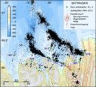
Grímsvötn 2010
A glacier outburst flood (jökulhlaup) emerged from beneath the Vatnajökull ice cap on October 31, 2010. The floodwaters originate in the subglacial lake Grímsvötn, 50 km upstream from the glacier margin. This article presents updated information daily.
Read moreUpdate on activity in Eyjafjallajökull 2010
This article comprises all daily and weekly comments in April, May and June, on the eruption in Eyjafjallajökull in 2010. Also, a few photographs taken in autumn when eruptive activity had ceased.
Read moreQA on the eruption in Eyjafjallajökull 2010
This article answers the most frequently asked questions regarding the eruption in Eyjafjallajökull that began in April 2010.
Read moreForecast for volcanic ashfall 2010
Here, an ashfall forecast for Iceland has been provided. The eruption activity at Eyjafjallajokull volcano is minimal and therefore no ashfall is expected. The volcano is still being monitored and an ashfall forecast will be issued if neccessary.
Read more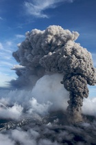
Photos from Eyjafjallajökull
List of recent volcanic eruptions in Iceland
This article contains a list of eruptions in Iceland since the beginning of the 20th century; as well as links to various web-sites describing the latest volcanic events.

An eruption in South Iceland
Concise description by Dr. Freysteinn Sigmundsson and other scientists on the events in the Eyjafjallajökull volcanic system and the eruption on Fimmvörðuháls.
Read more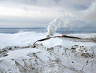
Photos from Fimmvörðuháls
Of interest - Bárðarbunga
Related topics
- Instructions on using earthquake pages
- Bárðarbunga and Holuhraun 2014-2015 - overview
- Grímsvötn 2011 - overview
- Eyjafjallajökull 2010 - overview
- Useful links
- FutureVolc
- Road conditions
- Earthquake Engineering Research Centre - University of Iceland
- Incorporated Research Institutions for Seismology
- National Earthquake Information Center
- Preventive response to earthquakes


