Field trips
Three Mid-Conference fieldtrips have been organized for conference participants on 7th September. These are included in the registration fee. See outline of each trip below (or optionally in the menu to the left).
M-1 Interior Iceland
 This trip
will be led by geologist Olivier Bourgeois at the University of Nantes,
France, and glaciologist Thorsteinn Thorsteinsson at the Icelandic
Meteorological Office, Reykjavík.
This is in many ways the
“classical” first trip for many visitors to Iceland, often referred to
as the “Golden Circle”. The trip takes you to places that are by now
becoming a bit overcrowded with tourists, but it is nevertheless
strongly recommended for those who have not been here before.
The first
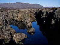
stop will be at the Viking age parliament site at Þingvellir, the most
important historical site in Iceland and a place of great geological
interest as well. At Þingvellir, effects of the separation of the
N-American and Eurasian tectonic plates on the Mid-Atlantic ridge can
clearly be seen in the form of large rifts on both sides of a several km
wide rift valley.
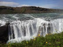
 Next we will stop at the famous waterfall Gullfoss in
the Hvítá canyons, which may have been formed in a catastrophic flood
at the end of the ice age. We continue into the interior with a view
towards many volcanic formations, some of them due to subglacial
eruptions. A stop will be made near the summit of an ancient shield
volcano, Skálpanes, formed during one of the Late Pleistocene
interglacials. From the summit of Skálpanes participants will (weather
allowing!) have a good view of the Langjökull and Hofsjökull ice caps in
Central lceland.
Returning to the south, the group will stop at the
Geysir geothermal fields, to witness eruptions in Strokkur and see the
now calm Great Geysir, which gives name to all the world´s geysers.
Return to Reykjavík will be along a route passing through the plate
boundary where it runs through the Reykjanes peninsula.
Please note that the interior site at Skálpanes (at 800 m elevation) can only be visited in reasonably good weather conditions. Snowfall might have occurred prior to the visit up there, making bus travel impossible. If Skálpanes cannot be visited, a visit to the Hellisheiði geothermal power plant may be included in the itinerary.
M-2 West Coast Iceland

The excursion passes through fjord landscapes on the west coast. Focus is on Tertiary and Early Pleistocene volcanism, glaciation history and glaciomarine sediments. An overview will be given on the geology of the Reykjavík area and a stop will be made at a site where a landslide has fallen from the western side of the Esja plateau.
Continuing under the slopes of Mt. Akrafjall, hillside gullies that bear a striking resemblance to Mars gullies will be observed. The route passes through moraines dating from the final cold spell of the last glacial period, the Younger Dryas (12.9 - 11.7 ka BP).
Stops include a coastal site displaying 15-30 m high cliffs of glaciomarine sediments deposited during the last deglaciation and a site with the highest Late-Glacial raised beaches known in Iceland.
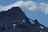
The route continues into the Borgarfjörður district, where a well-known anticline in the layering of Late-Tertiary basalts can be viewed. Continuing eastward, the ice cap Langjökull will be visible in good weather, as well as the large subglacially erupted tuya Eiríksjökull. Visit to the hot spring Deildartunguhver and lunch stop at the historical site Reykholt.
On the way back to Reykjavík, stops will be made in Hvalfjörður (the Whale Fjord), where a central volcano was active 2.4 - 3.1 Myr ago and a location where subglacially erupted hyaloclastites and glacial deposits are intercalated between interglacial lavas formed subaerially.
Please note that an earlier, short description of this excursion mentioned the possibility of a visit to a site on Mt. Skálafell, where periglacial phenomena can be studied. A gravel road leads to the summit of Skálafell but unfortunately the bus will not be able to climb that route and a walk to the summit will take too much time.
M-3 Southern Coast Iceland
This trip will be led by geologists Oddur Sigurðsson, Icelandic Meteorological Office, and Marion Massé at the University of Nantes, France.
This trip passes into a region of geological activity and flooding resulting from subglacial eruptions. After driving through the plate boundary on the easternmost part of the Reykjanes peninsula, the route passes through the Southern Iceland seismic zone, where four M 6.5 - 6.6 earthquakes occurred in the years 2000 and 2008. The subglacially erupted tuya Ingólfsfjall will be visible from the road between the towns Hveragerði and Selfoss.
Continuing into the lowlands of SW Iceland, the tour leaders will inform about the lavas from the large Þjórsá eruption 8600 years ago, which may be the most voluminous lava flow on Earth during the Holocene (last 11,700 years). Moraines dating from the Younger Dryas cold spell at the end of the ice age (12.9 - 11.7 ka BP) will be visible en route and in good visibility there will be a view towards the volcanoes Hekla and Tindfjallajökull, as well as to the volcanic islands Surtsey and Vestmannaeyjar 10 - 25 km south of the coast.
 The route passes under
Eyjafallajökull, the volcano that shut down air travel within Europe for
a week in 2010. A video on the eruption will be viewed at the farm
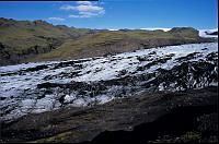
Þorvaldseyri. Next stop is the glacier Sólheimajökull, an outlet glacier
from the ice cap Mýrdalsjökull. The tour guides will inform about the
variations of this glacier in historical time, about mass balances and
glacier dynamics, the ages of different moraines and the geomorphology
of the glacier foreland. A walk on the glacier is included in the itinerary.
The route continues eastward and participants will walk upon the hill Hjörleifshöfði and have an excellent view over the Mýrdalssandur plains, which have repeatedly been engulfed by catastrophic floods caused by subglacial eruptions in the volcano Katla, within the Mýrdalsjökull ice cap. If time allows, stops will be made at the waterfalls Skógafoss and Seljalandsfoss on the way back to Reykjavík.
Please note that the Sólheimajökull glacier has changed rapidly in recent years, and the glacier can not be accessed from the front anymore. Access at another location has been possible recently. All participants will be required to wear crampons during the glacier walk. The crampons will be provided. It is very important to follow all advice and rules set by the tour leaders. Be careful not to stray away from the group.
Further information
Please contact Thorsteinn Thorsteinsson, glaciologist, Icelandic Meteorological Office, thor@vedur.is, if you have any further questions.


