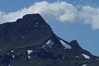
West Coast Iceland
Field trip M-2

The excursion passes through fjord landscapes on the west coast. Focus is on Tertiary and Early Pleistocene volcanism, glaciation history and glaciomarine sediments. An overview will be given on the geology of the Reykjavík area and a stop will be made at a site where a landslide has fallen from the western side of the Esja plateau.
Continuing under the slopes of Mt. Akrafjall, hillside gullies that bear a striking resemblance to Mars gullies will be observed. The route passes through moraines dating from the final cold spell of the last glacial period, the Younger Dryas (12.9 - 11.7 ka BP).
Stops include a coastal site displaying 15-30 m high cliffs of glaciomarine sediments deposited during the last deglaciation and a site with the highest Late-Glacial raised beaches known in Iceland.
The route continues into the Borgarfjörður district, where a well-known anticline in the layering of Late-Tertiary basalts can be viewed. Continuing eastward, the ice cap Langjökull will be visible in good weather, as well as the large subglacially erupted tuya Eiríksjökull. Visit to the hot spring Deildartunguhver and lunch stop at the historical site Reykholt.
On the way back to Reykjavík, stops will be made in Hvalfjörður (the Whale Fjord), where a central volcano was active 2.4 - 3.1 Myr ago and a location where subglacially erupted hyaloclastites and glacial deposits are intercalated between interglacial lavas formed subaerially.
Please note that an earlier, short description of this excursion assumed a visit to a site on Mt. Skálafell, where periglacial phenomena can be studied. A gravel road leads to the summit of Skálafell but unfortunately the bus will not be able to climb that route and a walk to the summit will take too much time.


