
Bárðarbunga earthquakes 3D
Updated three dimensional video - NEW
The Bárðarbunga seismic activity can be explored in three dimensional videos which show the earthquakes.
16 - 26 August 2014
In this video, earthquakes near Bárðarbunga are shown in time and in three dimensions over a period of ten days. An unusual presentation in the sense that the surface location is shown on a topographic map at the bottom, instead of at the top, in order to improve visibility and clarify the connection between location and depth.
The gray planes represent depths at 0 km, 5 km and 10 km from the true surface. The colour code of the earthquakes indicates days as counting from 16th August which is generally considered to be the onset of this sequence of events. The size is not indicated, all the dots are equally big.
Same earthquakes are shown on the topographic map as in the 3D above, for easy grasping of facts. The height is exaggerated by factor 5 in order to bring forth the landscape. The dept is also multiplied by 5 in order to distinguish between the earthquakes.
Location, depth and age of earthquakes in Bárðarbunga 16 - 26 August 2014.
IMO's specialist, Bogi B. Björnsson, compiled this video from the available data.
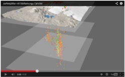
16 - 20 August 2014
The Bárðarbunga seismic activity can now be explored in a three dimensional video (30 sec.) which shows earthquakes from 16th to 20th August 2014.
Location, depth and age of earthquakes in Bárðarbunga 16-20 August 2014.
The colour of the dots implies the date: First there are red dots, then orange, yellow, light-green and then green. Please note that height and depth are exaggerated five times in order to show the topography explicitly and to expand the space between the earthquakes at depth.
The magnitude of the earthquakes is not shown; all dots are of equal size in this video. The same dots are shown on the surface as at depth for better harmony between the two. The depth of the earthquakes is indicated by the horizontal planes which are set at 0 km, 5 km and 10 km depth below sea level.
IMO's specialist, Bogi B. Björnsson, compiled this video from the available data.


