The Volcano Alert Level System (VALS)
VALS is a new system currently under development at the Icelandic Meteorological Office (IMO). Its purpose is to provide clear and simplified information about activity of volcanic systems in Iceland, whether any changes are occurring in activity and what potential hazards such activity might pose in the vicinity of the volcanic system.
The system is based on available monitoring data, interpretations of multi-disciplinary geophysical and geochemical parameters, expert experience from past episodes of unrest and knowledge of past eruptions.
Color-coded alerts
The VALS consists of four levels, ranging from Level 0 (green) to Level 3 (red). Level 0 is the lowest alert level, representing normal background activity within the expected range for a stable volcanic system, i.e. in equilibrium. Level 1 and Level 2 are two intermediate stages, indicating activity outside normal equilibrium levels. Level 2 reflects an increased number of indicators for a potential eruption and faster changes in monitoring data. Level 3, the highest level, corresponds to a state where an eruption is imminent or already in progress.
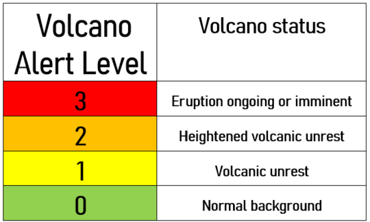
Volcano alert level and the associated volcano status.
For each alert level, hazards are identified and listed. The hazards considered in each case depend on the specific volcanic system in question and describe the phenomena believed to take place in its vicinity and surrounding area (regardless of distance and/or direction). Even if the alert level is 0, natural hazards may still be present in the area, and hazard may develop within an undefined timeframe. Thus, a volcanic system could move directly from alert level 0 to alert level 3 with no gradual steps and volcanic hazards (and volcanic eruptions) might occur without warning.
Difference between aviation color code (ACC) and VALS
The IMO has for several years issued aviation color codes (ACC)for the active volcanic systems in Iceland. The ACC follows the recommendations of the International Civil Aviation Organization (ICAO) and provides information about status of volcanoes that could affect air traffic to pilots, the public, and aviation authorities. The new VALS system is intended to convey information that may potentially affect areas on the ground. It is important to recognize that these two color codes may differ at any given time.
Example of use of the VALS
In the short-term hazard assessment for the volcanic unrest on the Reykjanes Peninsula, an alert level is issued for the volcanic system “Reykjanes/Svartsengi.” In the example below, the alert level is “2 – Heightened volcanic unrest (orange).” (See the blue box).
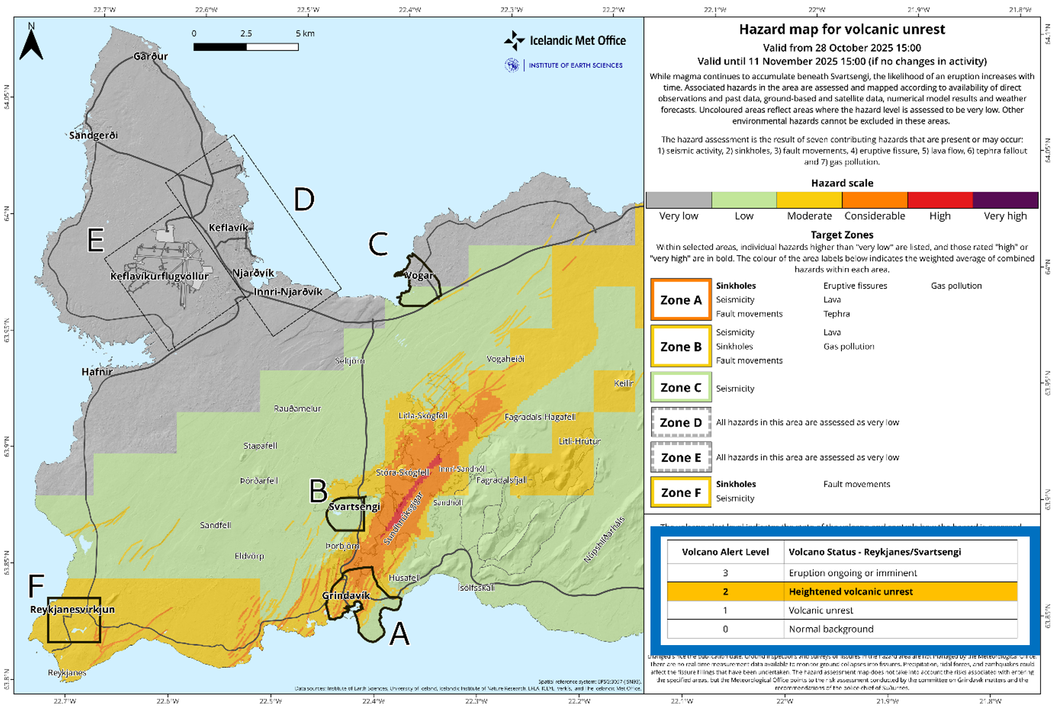
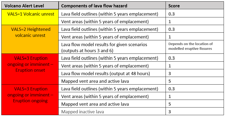
For the Svartsengi volcanic system, seven hazards are considered: 1) seismic activity, 2) sinkholes, 3) fault movements, 4) eruptive fissures, 5) lava flow, 6) tephra fallout and 7) gas pollution. The type of data used, and their relative importance, depends on the volcano's alert level at any given time. A hazard map is not produced when the alert level of a volcanic system is 0. The table below shows how the lava hazard assessment changes according to the VALS levels.