Flood warning system and jökulhlaups - Eyjafjallajökull
Oddur Sigurðsson, Gunnar Sigurðsson, Bogi B. Björnsson, Emmanuel P. Pagneux, Snorri Zóphóníasson, Bergur Einarsson, Óðinn Þórarinsson, Tómas Jóhannesson
Jökulhlaups (glacier outburst floods) are more common in Iceland than elsewhere in the world because of the interaction of volcanoes with glaciers.
The greatest jökulhlaups from the subglacial Katla volcano are among the largest floods that humans have witnessed. At their maximum, the discharge may be larger than the average discharge of the River Amazon.
Icelanders have learned to avoid the outwash plains of the most frequent jökulhlaups, Mýrdalssandur and Skeiðarársandur, but the outwash plains of River Markarfljót, southern Iceland, and River Jökulsá á Fjöllum, northern Iceland, are potentially dangerous and jökulhlaups will sooner or later flood parts of the current farmlands in those areas.

A warning system is operated by the Icelandic Meteorological Office that informs Civil Protection Authorities of impending floods or jökulhlaups. Unusual increases in water level or electric conductivity at key water level gauges triggers a warning that is subsequently evaluated by scientists. Thus, Civil Protection Authorities may get a few hours' head start in preventing public hazard.
Eyjafjallajökull eruption 2010
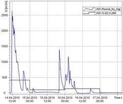
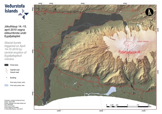
An important test was put to the system in the advent of the Eyjafjallajökull volcanic eruption on 14 April 2010. Only at this volcano and Öræfajökull volcano, southeastern Iceland, are floods expected to reach inhabited areas within an hour from the start of a volcanic eruption. Therefore, a quick response to warnings is essential. The gauges and equipment of the Icelandic Meteorological Office as well as the reconnaissance flights of the Icelandic Coast Guard played a key role in the response of Civil Protection Authorities and other officials to the hazard caused by jökulhlaups during the first days of the eruption.
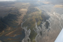
Particularly in the beginning of the eruption, the jökulhlaups were charged with volcanic debris as well as icebergs and advanced at a very high velocity (up to 20 km/h) and some were hot. Some of the jökulhlaups found their way along the bed of the glacier but others flowed over the surface of the glacier all the way to the ice margin.
The flooded areas were mapped for each jökulhlaup. The propagation of the flood fronts was observed, sometimes providing valuable data on the nature of these extraordinary floods.

More articles on the Eyjafjallajökull eruption 2010 are available on our web-site, as well as the then current news on the subject.


