
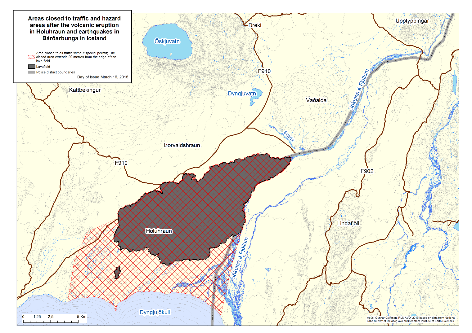
Prohibited area around the Holuhraun lava field
Possible danger of flooding
A reduction in the access controlled area was announced 16.03.2015 (pdf 0.8 Mb). An estimate of the danger of flooding was made, see bottom of page.

Preliminary flood risk assessment
Preliminary flood risk assessment for Jökulsá á Fjöllum gives flood travel times in minutes. The assigned locations (dots) are colour coded:
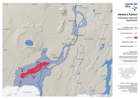
Red location (dot) is half an hour from the source, orange is an hour, dark yellow one and a half hours, bright yellow two hours, light green two and a half hours, green three hours and dark green three and a half hours from the source (see enlarged map).
The flood risk assessment above was used to redefine the prohibited area 17 Oct. 2014, see maps on the Bárðarbunga web of the Civil Protection Department of the NCIP. An update was made 13 February 2015 which does not affect the flood risk assessment above.


