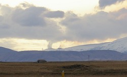
An eruption in South Iceland
Eyjafjallajökull - Fimmvörðuháls
An eruption began in South Iceland in late evening of 20th March 2010 at the Eyjafjallajökull volcanic system. This description is compiled by Dr. Freysteinn Sigmundsson at the University of Iceland.
The eruption is located on about 2 km wide pass of ice-free land between Eyjafjallajökull and the neighbouring Katla volcano with its overlying Mýrdalsjökull ice cap. Katla volcano is known for powerful subglacial phreatomagmatic eruptions producing basaltic tephra layers with volumes ranging from ~0.01 to more than 1 cubic kilometer.
The initial visual report of the eruption was at 23:52 GMT, when a red cloud was observed at the volcano, lightening up the sky above the eruptive site. The eruption was preceded with intense seismicity and high rates of deformation in the weeks before the eruption, in association with magma recharging of the volcano. Immediately prior to the eruption the depth of seismicity had become shallow, but was not significantly enhanced from what it had been in the previous weeks. Deformation was occurring at rates of up to a centimetre a day since March 4th at continuous GPS sites installed within 12 km from the eruptive site.
The eruption broke out with fire fountains and Hawaiian eruptive style on about 500 m long NE-SW oriented eruptive fissure at N63º 38.1, W19º 26.4; on the northeast shoulder of the volcano at an elevation of about 1000 m. It was observed from air from 4-7 A.M. on March 21st. Lava flows short distance from the eruptive site, and minor eruption plume at elevation less than 1 km was deflected by wind to the west. Little later the plume was recorded on animated radar images.
Volcanic explosive index is 1 or less. Tephra fall is minor or insignificant. The eruption occurs just outside the ice cap of Eyjafjallajökull, and no ice melting is occurring at present.
Three previous eruptions of Eyjafjallajökull are known in the last 1100 years (historical time in Iceland). The most recent began in December 1821 and lasted intermittently for more than a year. The neighbouring volcano Katla erupted then on 26 June 1823. Other eruptions include an eruption in 1612 or 1613, and about 920 A.D.
Episodes of unrest are known at Eyjafjallajökull, with documented sill intrusions in 1994 and 1999.
For information see:
Global Volcanism Program at the Smithsonian Institution
Institute of Earth Sciences, Iceland
Geophysical research at the Icelandic Meteorological Office
Continuous tremor plots at the Icelandic Meteorological Office
Earthquake location maps at the Icelandic Meteorological Office
Contacts and authors:
Nordic Volcanological Center, Institute of Earth Sciences, University of Iceland:
- Freysteinn Sigmundsson - fs(at)hi.is
- Magnús Tumi Guðmundsson - mtg(at)hi.is
- Guðrún Larsen - glare(at)raunvis.hi.is
- Sigrún Hreinsdóttir - runa(at)hi.is
- Páll Einarsson - palli(at)hi.is
- Ingibjörg Jónsdóttir - ij(at)hi.is
Icelandic Meteorological Office, Reykjavik, Iceland:
- Steinunn Jakobsdóttir - ssj(at)vedur.is
- Kristín S. Vogfjörð - vogfjord(at)vedur.is
- Sigurlaug Hjaltadóttir - slauga(at)vedur.is
- Gunnar B. Guðmundsson - gg(at)vedur.is
- Matthew Roberts - matthew(at)vedur.is
- Einar Kjartansson - eik(at)vedur.is


