
Home-page - Icelandic Meteorological Office
Weather forecast
Weather forecast for the next 24 hours
Northwest 5-15 m/s in the far west and east 8-13 by the northeast coast, but calmer wind elsewhere. A few rainshowers, but rain in Vestfirdir and East-Iceland.
South or variable wind 3-8 m/s tomorrow. Light rainshowers in most parts, temperature 5 to 10 deg. C.
Forecast made 09.10.2026 15:07
If the map and the text forecast differs, then the text forecast applies
Forecast for station - 1
Forecast for station - 2
Forecast for station - 3
Forecast for station - 4
Forecast for station - 5
Maximum wind in Iceland today
| Lowlands | |
|---|---|
| Highlands | |
|---|---|
Maximum and minimum temperature in Iceland today
| Lowlands | |
|---|---|
| Highlands | |
|---|---|
Maximum precipitation in Iceland today
| Lowlands | |
|---|---|
| Highlands | |
|---|---|
Maximum wind in Iceland during the last hour
| Lowlands | |
|---|---|
| Highlands | |
|---|---|
Maximum and minimum temperature in Iceland during the last hour
| Lowlands | |
|---|---|
| Highlands | |
|---|---|
Maximum precipitation in Iceland during the last hour
| Lowlands | |
|---|---|
| Highlands | |
|---|---|
Preliminary results
Earthquakes
Earthquakes during last 48 hours. at 09 Oct 21:35 GMT
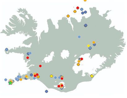

Biggest earthquakes during the last 48 hours
| Size | Time | Quality | Location |
|---|---|---|---|
| 3.4 | 08 Oct 17:50:27 | Checked | 2.7 km WNW of Geirfugladrangur |
| 2.7 | 08 Oct 20:38:11 | Checked | 1.3 km N of Geirfugladrangur |
| 2.6 | 08 Oct 20:18:48 | 50.0 | 5.8 km N of Geirfugladrangur |
Specialist remark
An earthquake swarm began yesterday around 17:00, approximately 20 km west-southwest of Eldey on the Reykjanes Ridge. The largest earthquake recorded measured M3.4. More than 130 earthquakes have been recorded in the swarm so far. Earthquake swarms are common on the Reykjanes Ridge.
Written by a specialist at 09 Oct 06:25 GMT
Week overview -
Earthquake activity throughout the country is described in a weekly summary that is written by a Natural Hazard Specialist. The weekly summary is published on the web every Tuesday. It covers the activity of the previous week in all seismic areas and volcanic systems in the country. If earthquake swarms are ongoing or significant events such as larger earthquakes have occurred during the week, they are specifically discussed. More
Hydrology
Average flow and temperature last 24 hours
| River | Place | Flow | Water temperature |
|---|
Remarks of a specialist
Electrical conductivity has been measured quite high for the last 24h, about 260 microS/cm. Gas pollution near Láguhvolar is fluctuating due to wind and due to heavy rain yesterday morning, the water level in Múlakvísl is quite high and thus travelers are urged to exercise caution and stay away from the riverbanks.
Due to malfunction we have turned off the service publishing hydrological data on the map. Instead see the data using our Rauntímavöktunarkerfi.
Written by a specialist at 09 Oct 01:45 GMT
Avalanche forecasts are now published on Icelandic Met Office’s new website:
New avalanche pages on gottvedur.is/en
News from the Icelandic Met Office’s landslide monitoring service are now published on a new site for landslide warnings on gottvedur.is
News
New risk assessment for people's safety in Grindavík available on the municipality's website
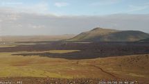
Situation on the Reykjanes Peninsula
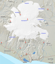
Increased electrical conductivity and gas pollution at Múlakvísl
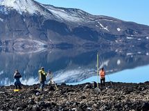
Measurements show that uplift at Askja has ceased
Measurements by the lake in Askja. Fieldwork in the area was completed this week, and the results indicate that the uplift episode that began in 2021 has ended.
Read moreIncreased hazard due to changing conditions at the margin of Sólheimajökull glacier
Recent changes at the terminus of Sólheimajökull call for increased caution. Unstable glacier ice and rockfall from the surrounding slopes may pose a risk to people visiting the area.
Read more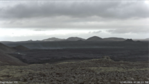
Ground uplift and magma accumulation continue beneath Svartsengi
Short articles
Avalanches in Iceland
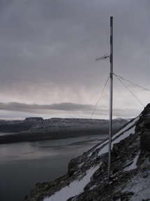
Catastrophic avalanches in the villages Súðavík, 16 January 1995, and Flateyri, October 1995, which killed 34 people and caused extensive economic damage, totally changed the view regarding avalanche safety in Iceland.
New publications and research
- Guðrún Nína Petersen (2025). Alviðruhamrar - Meteorological conditions
- Michelle Parks, Freysteinn Sigmundsson, Vincent Drouin, Ásta R. Hjartardóttir, Halldór Geirsson, Andrew Hooper, Kristín S. Vogfjörð, Benedikt G. Ófeigsson, Sigrún Hreinsdóttir, Esther H. Jensen, Páll Einarsson, Sara Barsotti & Hildur M. Friðriksdóttir. (2023).
- Sahar Rahpeyma, Benedikt Halldórsson, Birgir Hrafnkelsson & Atefe Darzi. (2023). Frequency-dependent site amplification functions for key geological units in Iceland from a Bayesian hierarchical model for earthquake strong-motions.
- Sara Klaasen, Solvi Thrastarson, Yesim Cubuk-Sabuncu, Kristín Jónsdóttir, Lars Gebraad, Patrick Paitz & Andreas Fichtner. Subclacial volvano monitoring with fiber-optic sensing: Grímsvötn, Iceland. (2023).
- Ismael Vera Rodriquez, Marius P. Isken, Torsten Dahm, Oliver D. Lamb, Sin-Mei Wu, Sigríður Kristjánsdóttir, Kristín Jónsdóttir, Pilar Sanchez-Pastor, John Clinton, Christopher Wollin, Alan F. Baird, Andreas Wuestefeld, Beat Booz, Eva P.S.Eibl, Sebastian Heimann, Bettina P. Goertz-Allmann, Philippe Jousset, Volker Qye, Vala Hjörleifsdóttir, Anne Obermann. (2002).
- Lamb, O.D., Gestrich, J.E., Barnie, T.D., Jónsdóttir, K., Ducrocq, C., Shore, M.J., Lees, J.M., Lee, S.J (2022). Acoustic observations of lava fountain activity during the 2021 Fagradalsfjall eruption, Iceland. Bull Volcanol 84, 96. doi.org/10.1007/s00445-022-01602-3
- Freysteinn Sigmundsson, Michelle Parks, Andrew Hooper, Halldór Geirsson, Kristín S. Vogfjörd, Vincent Drouin, Benedikt G. Ófeigsson, Sigrún Hreinsdóttir, Sigurlaug Hjaltadóttir, Kristín Jónsdóttir, Páll Einarsson, Sara Barsotti, Josef Horálek & Thorbjörg Ágústsdóttir (2022). Deformation and seismicity decline before the 2021 Fagradalsfjall eruption. Nature 609, 523–528. doi.org/10.1038/s41586-022-05083-4
Search
Contact IMO
© Veðurstofa Íslands | Bústaðavegi 7- 9 | 105 Reykjavík | Phone 522 6000 | Fax: 522 6001
Recording 902 0600 | SSN 630908-0350
Contact us | Employees | Terms and conditions | Sitemap


