News

Warning banners removed
With enhanced SO2 monitoring capabilities and regular dispersal forecasts IMO has decided to remove the yellow warning ribbon from the header of IMO's web.
The gas dispersal forecasts will still be available and monitoring of the SO2 release and dispersal will not decrease. The warning ribbon will be used if the values of SO2 are forecasted or measured to exceed the public safety limits for longer periods of time.
IMO has also decided to remove the warning for an eruption in Holuhraun, as there have not been any significant changes. The eruption is still as closely monitored as ever. Should there be any significant changes new warnings will be issued.
Festive forecast
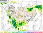
Fine weather is forecast on New Year's Eve and New Year‘s Day in all of Iceland.
Tomorrow morning, winds will be southerly in most of the country, 8-13 m/s with sleet or intermittent rain, but in the afternoon lighter winds are forecast in northern and eastern Iceland with brighter skies.
At midnight, winds will be calm everywhere although light snow showers are expected in the south and the west. Temperatures will be close to zero.
New Year‘s Day has also a fine weather forecast; slow wind, scattered hail and 0°C. Some snow is, however, expected at the northern coast part of the day.

Snow avalanche stopped by a catching dam
A snow avalanche released from the mountain slope above the village of Siglufjörður in N-Iceland was stopped by a protective dam, most likely on 12 December.
The avalanche started in a gully below a shelf in the middle of the mountainside at approximately 340 m a.s.l.
The avalanche hit the dam along a more than 50 m distance and left rocks and branches that it picked up on its way on the damside. It was approximately 2 m short of reaching the top of the dam and threw some snow clods over the dam crown.
It is likely that the avalanche would have reached close to or hit the uppermost houses if it had not been stopped by the dam.
Read more
The segmented dyke intrusion explained
Advanced online publication in Nature reports research by an international team of geoscientists on the formation of the intrusive dyke which extends 45 km in the subsurface from the Bárðarbunga central volcano to the eruptive site in Holuhraun. There, the eruption has been ongoing for more than 100 days.
The paper in Nature reports how the dyke formed mostly over two weeks prior to the onset of main eruptive activity. A model for the dyke also explains unusual and varying direction of dyke segments, that relate to interaction of topography and stresses in the ground caused by divergent plate movements in Iceland.
The team includes 37 scientists from the University of Iceland, the Icelandic Meteorological Office and eight universities in other countries. This is part of the research project FUTUREVOLC funded by the European Union.
Read more
What is Bárðarbunga?
There are about 30 known central volcanoes, or volcanic systems, in Iceland. Bárðarbunga, the second highest mountain of Iceland. A caldera in the volcano's crown is covered with approximately 850 m thick glacial ice. Eruptions can occur in the caldera, on the sides or in the fissure swarms. Because of the current seismic activity in northwestern Vatnajökull, IMO has been allowed to publish the chapter Bárðarbunga System, an extract from a much larger work in progress.
Read more
Gale force wind in Westfjords
Very high northeasterly winds (25-35 m/s) are forecasted in the northern Westfjords this afternoon, 9 December.
At Hornstrandir and by Ísafjarðardjúp, including habited areas, the weather will worsen considerably between 2 – 3 PM with these high winds and snow.
This evening and tonight northeasterly winds 20-28 m/s are forecasted with snow and hail in all the Westfjords. Tomorrow morning, 10 December, winds will calm down.
See also warning of high tide.
Warning - high tides in the Westfjords
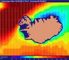
High seas are expected off the shores of the Westfjords on Tuesday evening 9 Dec. and Wednesday morning (10 Dec.).
Because of the tide, a warning is issued; waves and surf on the relevant coasts might become unsually strong. Waves over 12 m from the north and northeast are forecasted.
Warning for Sunday and Monday
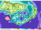
IMO draws attention to the weather forecast of strong or whole gale for this coming Sunday and Monday. Flooding may occur.
Westerly and southwesterly winds, 20-30 m/s, can be expected; in the southern part of Iceland on Sunday evening but in the northern part early on Monday morning. Cooler air will follow the westerly winds, with precipitation changing from rain to snow showers at sea level. Average wind speeds may be expected to exceed 28 m/s, which is whole gale according to the Beaufort wind scale. Wind gusts can be expected to reach 50 m/s, especially to the north and east of mountains (the leeside). This results in very poor travelling conditions.
A warning due to flooding has also been issued. There will be heavy rain and fording rivers may become dangerous in certain areas.

The FutureVolc project and the eruption on National Geographic
National Geographic published a web article recently on the eruption in Iceland, how its timing contributes to the FutureVolc project and how, thanks to new instruments deployed by FutureVolc, this is one of the best monitored eruptions in history.
There is a video from the field and interviews with the scientists. The reasons why Iceland was chosen to lead the international project are given. The importance of open data is discussed and two data products developed at the Icelandic Met Office are shown.
Read more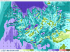
Warning – the first real snow of autumn in northern Iceland
The Icelandic Met Office warns against the first real snow of autumn in northern Iceland. Northerly wind, strong gale force, is expected with snowfall in the northern part. In the North travelling is not recommended, neither on Monday nor Tuesday, especially not in cars which have not been prepared for winter driving.
Read more
The weather in Iceland in 2050
The United Nations' Climate Week NYC was held in New York. It is the collaborative space for all related events in support of the UN Climate Summit. Iceland's representative on the climate week was Birta Líf Kristinsdóttir, Icelandic Met Office, one of eleven TV meteorologists who were asked to make a weather forecast for their own country in 2050 based on the visions of the newest IPCC report. These weather forecasts of the future are presented as a set of videos, published one per day until the summit. The Icelandic video consist of a weather forecast with English subtitles and an account in English of the major effects of global warming in the country. Every video is concluded by UN Secretary-General's call for action on climate change.
Read more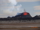
A glimpse into the field
In this news article, a report of three days in the field is presented with portraits of the key players in this show of nature‘s dangerous forces: Suðri, Baugur and Baugur‘s babies, while Norðri, active some days ago, doesn‘t deserve a mention anymore. Fate turns quickly in the field.
Given the dangerous gas levels at the eruptive site which get carried, albeit dispersed, from the highlands down into the deep firths of the Eastfjords and their farming grounds and fishing villages; the Icelandic Met Office has begun to issue warnings when necessary. They are found in a yellow ribbon in the header of every web page of en.vedur.is when relevant. When no warnings are being issued, the yellow ribbon disappears.
Read more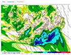
Bad weather expected on Sunday
A deep and sharp low will approach Iceland from the southwest 31st August. Southerly and southeasterly winds are expected, 25-25 m/s, and very strong gusts near mountains. Considerable rain will probably follow in all of the country, especially in the Southeast and there is a risk of mudslides in Southeast. People are advised to check on their property and fasten loose objects. This low is the remains of "Cristobal" which caused damage in the Caribbean last week-end. Travellers are advised against fording rivers in South Iceland.
Hard work in harsh circumstances
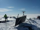
Since the first day of the seismic activity, technical and scientific staff have worked hard under tough circumstances. Long distances have been traversed in specialised vehicles or staff have been transported by the Coast Guard‘s helicopter. They report to headquarters twice a day and their positioning is monitored continually. The equipment which is being mounted must endure harsh environment. This significant enhancement of monitoring was made possible by, Future Volc, and by the University of Cambridge.
A reconnaissance flight with TF-SIF
A flight was made to Bárðarbunga and along the glacial river, with the aircraft TF-SIF from the Icelandic Coast Guard. The onboard SAR-radar was used to image the glacier and the river.
If the present seismic activity in Bárðarbunga leads to an eruption and consequently a glacial outburst flood (jökulhlaup), these images will become an important dataset for estimating the changes which may occur on the glacier and on the flooded area.
Read more
Seismic activity still great
07:04 Seismic activity in Bárðarbunga and vicinity is still great. As yesterday, the main activity stems from the intrusive event under Dyngjujökull. A few earthquakes, shallower than those described above, have occurred in Bárðarbunga, where the activity started. This is the same pattern as during previous days.
Additional web-material in English is now available through links in the header.

Updated summary from Bárðarbunga
12:56 Around 1.000 small earthquakes were detected in the Bárðarbunga region from midnight (18/19) until Tuesday evening 19th August at 20:00. All of them were smaller than magnitude 3 and most were located in the cluster east of Bárðarbunga. Events are still located at around 5-12 km depths, no signs of upwards migration has been seen so far.
Read more
Summary of activity in Bárðarbunga
09:43 Since the onset of the earthquake swarm at Bárðarbunga on Saturday morning, around 2.600 earthquakes have been detected with the earthquake monitoring network of the Icelandic Meteorological Office (IMO). Throughout the whole sequence the majority of events has been at 5-10km depth. No signs of migration towards the surface or any other signs of imminent or ongoing volcanic activity have been detected. IMO is monitoring the area closely and will update in case of any changes.
Read more
Seismic activity at Bárðarbunga persists
11:35 The intense seismic activity that started 16 August at Bárðarbunga persists. Very strong indications of ongoing magma movement, in connection with dyke intrusion, is corroborated by GPS measurements. Presently there are no signs of eruption, but it cannot be excluded that the current activity will result in an explosive subglacial eruption, leading to an outburst flood (jökulhlaup) and ash emission. The situation is monitored closely.
Read more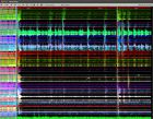
Activity in Bárðarbunga volcano
20:51 Seismic activity in Bárðarbunga volcano has increased. A seismic swarm has been ongoing since 03AM this morning, and near continuous earthquakes have been occurring since then. The depths of earthquakes in the present swarm are in the upper crust and their magnitudes are mainly around 1.5; a few earthquakes are of magnitude greater than ML3.
Read more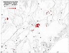
Earthquake swarm by Bárðarbunga volcano
15:00 At about 3 a.m. this morning (16 August), an earthquake swarm began by Bárðarbunga volcano in NW Vatnajökull ice cap. Over 200 earthquakes have been recorded. The largest earthquakes have magnitudes of around 3 and over.
Read more
On the Askja rockslide
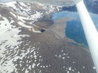
The rockslide which occurred in Askja 21 July 2014 and descended into the caldera lake is one of the largest known rockslides since the settlement of Iceland. Preliminary results are available on the web with photos, maps, graphs and thorough explanations. It takes a tsunami wave about 1–2 minutes to travel across the lake and sound takes about 10 sec to cover that distance. Thus, people have a very short time to escape if a big rockslide is released from the other side of the lake.
Rockslide into Askja caldera
An enormous rockslide fell into lake Öskjuvatn, from the southeastern rim of Askja, just before midnight 21 July 2014. As a consequence, a wave traversed the lake and into Víti, a smaller crater on the shore. No damage or casualty resulted, because neither tourists nor scientists were present. Parts of the caldera‘s rim might still be unstable and more material might fall into the lake. Traffic in the area is restricted until further notice. The responsible authority for the Askja region is the police in Húsavík.
Small glacial outburst floods around Mýrdalsjökull
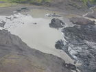
10.7.2014 Floodwater continues to drain from geothermal sources beneath Mýrdalsjökull into the rivers Múlakvísl and Jökulsá á Sólheimasandi. Conductivity levels in both rivers remain higher-than-normal, but the latest measurements show a slight decrease. Additionally, the discharge of both rivers is lower than earlier in the week.
Read more
Climate change and hydrology: Environmental and societal effects
The climate and hydrology of Iceland are highly variable due to natural conditions. Significant changes in these factors over the last 15 years are in harmony with the future scenarios represented and affirmed in the latest IPCC summary report, AR5. The main purpose of IMO is to contribute towards security in society by monitoring, analyzing, interpreting, informing; providing warnings and forecasts and predicting natural hazards. It is important to keep the infrastructure strong so that IMO may fulfill its role.
Read more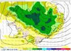
Weather warning - high winds and rain expected
Tomorrow, Tuesday, a rather deep low is forecasted in the southwest and west of Iceland. Heavy rain is expected, with the greatest amounts in the South tomorrow afternoon and evening. Rising stream and river levels are expected on the Snæfellsnes peninsula, the Hvítá region (both west and south of Langjökull), around the Eyjafjallajökull and Mýrdalsjökull ice caps, and south of the Vatnajökull ice cap. Travellers are cautioned against fording rivers in these regions.
Read more
An invaluable photo collection
Oddur Sigurðsson, geologist and a specialist in glaciological research, has taken striking photographs of the nature of Iceland for decades. The size of the collection is about 55,000 photographs. Changes in glacier margins, jökulhlaup, rock formations, volcanic eruptions, ash plumes, mudslides, landslides, rivers, river flows and waterfalls are amongst the phenomena found in this collection which is all the more valuable for its long time span.
Read more
An earthquake in South Iceland
At 23:14 (8th May) an earthquake of magnitude 4 occurred 10 km ESE of Hestfjall, South Iceland. Observations were received from the South Iceland lowland and from Hafnarfjördur, Borgarnes and Reykjavík.
Read more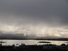
Safetravel
The web-site Safetravel is run by ICE-SAR and is part of a bigger project where a number of companies, public institutions and individuals combine their effort in order to minimize the risk of accidents in travelling and tourism in Iceland.
Thorough information on safe travelling can be found there. The 112 Iceland app can be downloaded and your travel plan can be left in safe hands before you go.
A small jökulhlaup in Gígjukvísl
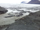
A small jökulhlaup, glacier outburst flood, occurred in the river Gígjukvísl in March. The event originated from the subglacial lake Grímsvötn. No threat was expected from the flood, which did not exceed high river discharge at summer.
The river Skeiðará changed its course in 2009 and now runs due west along the margin of Skeiðarárjökull outlet glacier and contributes to the river Gígjukvísl. Further information on the causes and consequences of this shift is given below.
Avalanche notices on the web - an improved map
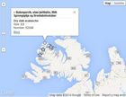
Real-time information about snowpack conditions, recent avalanches and avalanche danger is part of IMO's monitoring. Information about avalanches reported during the last ten days is now presented on the web in the form of an interactive map and a table. People are encouraged to report avalanches that they come across using a specific internet form.

Iceland a Member State of EUMETSAT
Iceland will now have unlimited access to satellite earth observation data that relates to many aspects of atmospheric, land and ocean monitoring. This will improve Iceland‘s forecasting capabilities, bringing significant benefits for key industries such as fisheries, agriculture and tourism, enhancing public safety and supporting other important areas such as road construction, research and education.
The weather in Iceland 2013
The weather in Iceland in 2013 was mainly favourable, however, the spring was harsh in the North and East and the summer was on the dull side in the South and West, with precipitation and cloudiness above average. This was the dullest summer of the new century in this area of the country.
Read more
Flood subsiding
The glacial outburst flood is thought to have peaked 20 January and is now subsiding. Photographs show the flood at its peak. Floods in Skaftá are sourced from two ice cauldrons, formed due to persistent geothermal activity beneath Vatnajökull. On average, the cauldrons drain every two years, producing floods of up to 1,500 cubic metres per second. When the interval between floods is short, the flood tends to be smaller.

Skaftá: a glacial outburst flood in progress
19.01.2014 Flood conditions are expected in Skaftá over the next two to three days. Some flooding of unpaved roads close to Skaftá is possible. Hydrogen sulphide is released from the floodwater as it drains from the Vatnajökull ice-cap. The gas is particularly potent at the ice margin, where concentrations will reach poisonous levels. Travellers must stay away from the edges of Skaftárjökull, Tungnaárjökull and Síðujökull while the flood occurs. Crevasses will develop rapidly around the ice cauldron, so travellers on Vatnajökull should stay away from the region, including the lower part of Skaftárjökull and Tungnárjökull, where floodwater could burst through the surface.
Read more


