
News
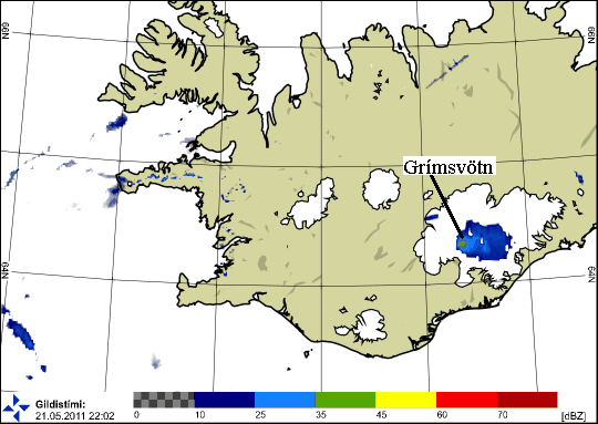
Image of the cloud from the eruption at 22:00 UTC. The image is from the Icelandic Met Office weather radar located at Keflavik International Airport, at 220 km distance from the volcano. The cloud extends above a large part of Vatnajökull ice cap. The line marks the approximate location of Grímsvötn volcano.


