
News
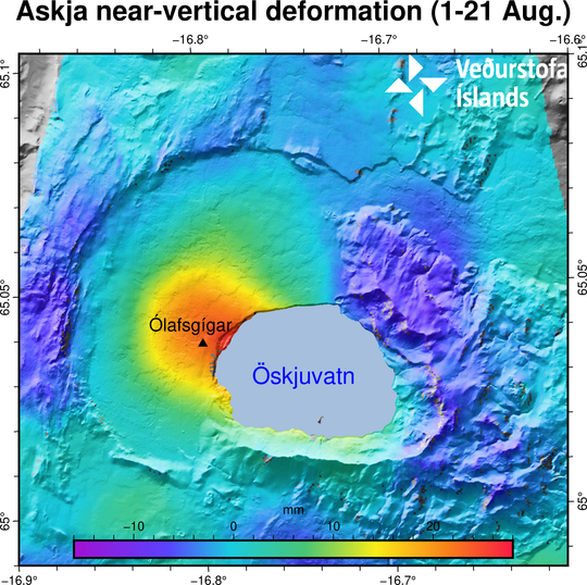
The image shows the near-vertical deformation in mm for the period 1-21 August. The InSAR image is obtained from two passages of Sentinel-1 satellite. The red color indicates uplift and the blue corresponds to subsidence (see the scale). The area experiencing the highest inflation is north-west Öskjuvatn. The black triangle indicates the location of the closest GPS station Ólafsgíga (OLAC).


