Earthquakes shake Bláfjöll ski-area
Two earthquakes of magnitude around M4 occurred, only 5 seconds apart,
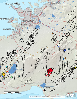
On the 13th of September at 20:17, two earthquakes of magnitude around M4 occurred, only 5 seconds apart, 6 km south of Bláfjöll mountains. Several smaller aftershocks were recorded. The earthquakes were felt widely in the capital area, and also in Ölfus and Akranes. The earthquakes are located on the tectonic plate boundary that lies eastwards along the Reykjanes peninsula where earthquakes of magnitude around M6 can occur.
Largest known earthquakes in the area occurred in the years of 1929, 1968 and 2000. The earthquakes in 1968 and 2000 were around magnitude M5.5, with epicenter north of lake Hlíðarvatn. The epicenter of the 1929 earthquake was most likely further to the west, at Brennisteinsfjöll mountains. The magnitude of that earthquake was around M6.2. Smaller earthquakes, around M4, are recorded regularly in the area, for example in 2012 when a M4.2 earthquake occurred at Helgafell in March and M4.6 earthquake at Vífilsfell in August, see older news: http://www.vedur.is/skjalftar-og-eldgos/frodleikur/greinar/nr/2908

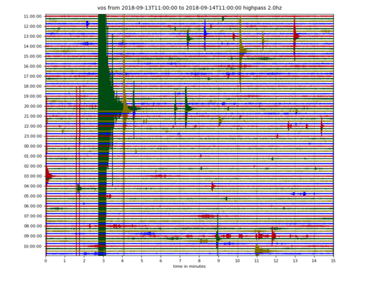
A drumplot from the seismic
station at Vogsósar, at 8 km distance from the M4 events.


