
The Civil Protection Scientific Advisory Board meets to discuss the status of Grímsvötn
The Civil Protection Scientific Advisory Board met on the 18th of June to discuss the latest measurement data from Grímsvötn. Participants included scientists from the Icelandic Met Office (IMO), Institute of Earth Sciences (IES) and the Environment Agency as well as representatives from Isavia-ANS, the National Commissioner of Police's Department of Civil Protection and Emergency Management and others.
Grímsvötn is the most active volcano in Iceland with typically 5-10 years between eruptions. About 20 eruptions have taken place in and around Grímsvötn in the last 200 years. The last eruption in Grímsvötn in 2011 was quite large and powerful, while the other recent eruptions have been rather small and lasted only a few days.
Volcanic eruptions in Grímsvötn have occurred
in the past at the end glacial floods as pressure is reduced due to lowering of
the water beneath the Vatnajökull ice cap.
Recent volcanic activity
The meeting reviewed activity in Grímsvötn in the past months and discussed measurements made in and around Grímsvötn in early June. While seismic activity has been increasing over the past year, in June it was still lower than in the months leading up to the most recent eruptions in 2004 and 2011. Measurements of land deformation show that land continues to rise since the previous eruption with no significant changes in the last year. The biggest measurable change was that sulfur dioxide (SO2) was detected close to the last eruption site. SO2 emissions give a strong indication of magma degassing.
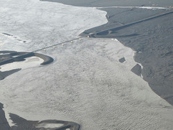
Measurements of the elevation of the ice over Grímsvötn made by IES show that it has risen 10 m steadily since last winter. It has not been higher since October 2010. A glacial flood from under the ice cap is therefore considered to be likely during this summer or autumn. In 2004, 1934 and 1922 volcanic eruptions started some days after the end of a flood, so the possibility that a flood this summer or autumn could instigate the start of an eruption must be considered.
In response to the increased possibility for a volcanic eruption at Grímsvötn, IMO has improved the volcano monitoring. A continuous GPS measurement station was installed on the ice cap in early June for real time monitoring of the elevation of the ice. Webcams were installed at Hamarinn and Skeiðarársandur looking towards Grímsvötn. Automatic real time processes now monitor the elevation of the ice cap and other changes of area and seismic activity. These improvements will help to provide early warning of the next flood and changes which might indicate the onset of an eruption.
Possible scenarios
Pressure due to magma accumulation has been growing over the past years and it is likely that it has reached the level that preceded the 2011 eruption. The following scenarios are therefore considered most likely:
- A glacial flood will commence in the coming weeks-months, the water levels under the ice will drop yet there will not be an eruption (as in 2010).
- A glacial flood will commence in the coming weeks-months, the water levels under the ice will drop and Grímsvötn will erupt. It is most likely that the eruption will be small to medium-sized with significant volcanic tephra fall on Vatnajökull glacier and little tephra outside the glacier (as in 2004). The eruption is most likely to start 5-8 days following the onset of the flood.
- An eruption will begin before the flood.
Visitors to Vatnajökull, especially those staying on Grímsfjall, are asked to keep in regular contact with others and to keep the potential eruption in mind while planning their trip. In case of an eruption, gas concentrations on the glacier could reach hazardous levels especially in depressions and in still air. During a glacial flood gas pollution can also be expected, especially close to the edge of the glacier where the flood originates.


