
News
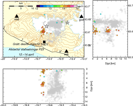
Map of earthquake locations 12-14 April 2010. New earthquakes are marked by yellow and orange dots. Older earthquakes are marked by gray dots (December 2009 - March 2010). The grey stars mark the eruption sites, the new one to the west. Black triangles are seismometers and a black square is a GPS meter. An earthquake size 3 is marked by a red star.


