
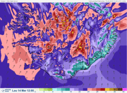
Severe weather, Saturday 14 March
People are advised to stay indoors
Confirmation of severe weather:
A violent storm with hurricane-force wind gusts will occur tomorrow, Saturday 14 March. IMO has issued warnings due to wind (southerly 20-30 m/s) with wind gusts exceeding 50 m/s.
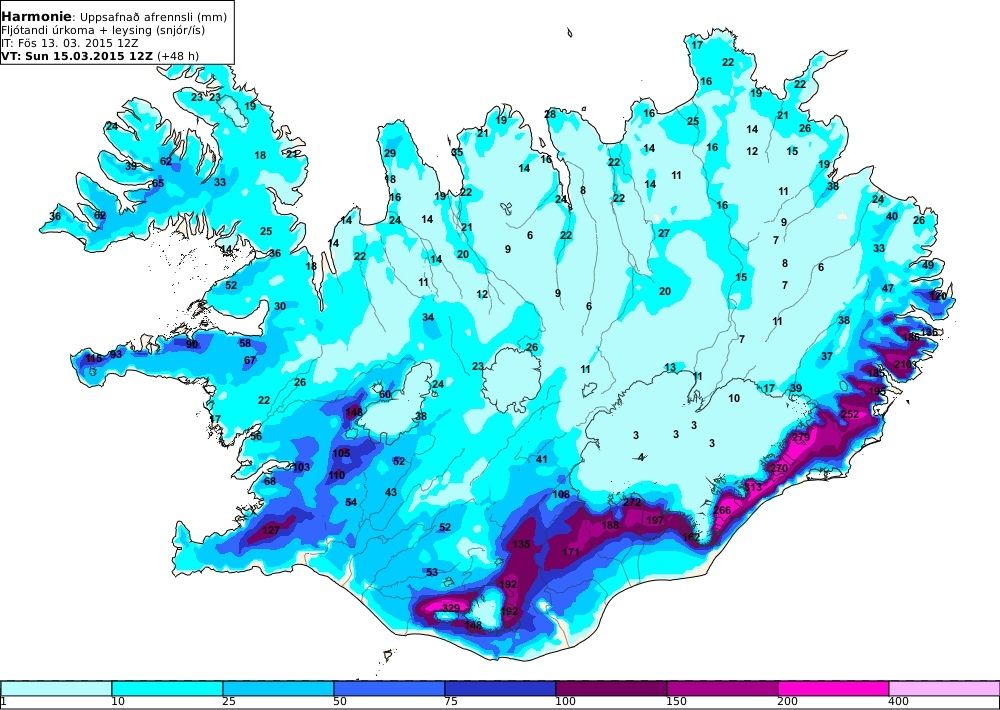
Intense rain and snow-melt is expected during the weekend. The most intense rainfall will occur in the south- and southeast of the country, especially around Mýrdalsjökull and south of Vatnajökull. Rising river levels are expected throughout the south of the country. Rapid melting of recently fallen snow could result in river- and stream floods, slush flows, and, possibly, mud flows.
National warnings for wind, rain, hazardous flash floods, wet snow avalanches, slush flows and landslides are in effect; see news yesterday (still valid) and updated map below.
The same weather warnings apply to Reykjavík and the surrounding area. Wind gusts on Saturday 14 March will make travel exceptionally hazardous. All non-essential travel should be avoided and people are advised to remain indoors.
Forecasts and warnings will be updated at three-hour intervals on our web-site.

Icelandic Meteorological Office, Friday 13 March, 16:40
Elín Björk Jónasdóttir, meteorologist
Matthew J. Roberts, coordinator for flood hazards
On behalf of the Division of Forecasts and Warning


